




Okay besties, today we’re talking mining tech — stay with me, because this one actually says something big about how data (and money) works.
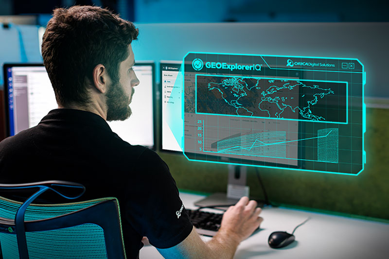
Orica just launched GEOExplorerIQ, a cloud-native geotechnical intelligence platform that pulls all of a mine’s geotechnical monitoring data into one place. The whole point? Help customers spot changes earlier and make smarter decisions. And honestly, that’s a money lesson hiding inside a mining story — so let’s unpack it. 💎
Think about what mining operations deal with: they’re monitoring ground conditions, slopes, subsurface movement, remote sensing data — all from different tools and systems. Before this launch, that data lived in silos. Different technologies, different dashboards, different teams. It’s like checking five different banking apps, a spreadsheet, a sticky note, and your Venmo history just to figure out your net worth. Technically possible, wildly inefficient, and way too easy to miss something important.
GEOExplorerIQ fixes that by bringing monitoring data, analytics, and workflows together into one unified view across surface, subsurface, and remote sensing technologies. Orica’s Matthew Craft, Head of Software Product and Development at Orica Digital Solutions, said the platform turns data into meaningful insights so customers can identify change earlier, reduce uncertainty, and make more informed decisions with confidence.
Here’s what I’d highlight: that phrase — reduce uncertainty — is everything. Whether we’re talking about a mine slope or your investment portfolio, the goal isn’t to eliminate risk (impossible). The goal is to see it clearly and earlier, so you can respond instead of react.
The platform was built inside Orica’s ODS platform, a secure cloud-native ecosystem, and it’s designed to progressively connect technologies across Orica Digital Solutions’ Geosolutions portfolio. That includes GroundProbe, NavStar, Measurand, RST Instruments, Syscom Instruments, 3vGeomatics, and selected third-party systems. Translation: one source of truth for geotechnical monitoring and risk management, instead of seven apps arguing with each other.
Once everything’s connected, users can connect and compare monitoring datasets, visualize trends, manage alerts and events, and support reporting workflows. Teams get a complete picture of changing ground and asset conditions — which means fewer surprises and faster, more confident calls when something shifts.
This is why I tell my coaching clients that consolidation beats fragmentation almost every time. When your information lives in one clear place, trends become visible. When trends are visible, you can act on them. Mines are applying this to ground stability; you can apply the exact same principle to your finances — one dashboard, one budgeting system, one clear view of what’s coming in and going out.
Now, let’s talk security, because that matters more than people realize. GEOExplorerIQ runs on Microsoft Azure infrastructure and aligns with ISO 27001-certified security standards. That gives organizations a secure, scalable foundation for monitoring operations, collaboration, and data management. If a platform is going to hold critical operational data, it needs to be locked down and able to grow with the customer — and this checks both boxes. (Same energy as making sure your brokerage is SIPC-protected, by the way. Security isn’t glamorous, but it’s non-negotiable.)
Orica’s leadership framed this as a bigger strategic move, too. Angus Melbourne, President and Chief Technology Officer of Orica Digital Solutions, said GEOExplorerIQ advances Orica’s strategy to create an open, secure and connected digital ecosystem for customers — and made the point that the future of geotechnical monitoring is not individual technologies working in isolation.
That line genuinely gets me excited, because it applies far beyond mining. The future of your money also isn’t individual tools working in isolation. Your savings account, your retirement account, your side hustle income, your debt payoff plan — when they all sit in separate corners, you’re making decisions with half the picture. Connect them, and suddenly you can anticipate instead of panic.
Melbourne also noted that GEOExplorerIQ brings monitoring technologies, data and workflows together, helping customers understand changing conditions, anticipate risk and respond with greater confidence. Notice the sequence: understand, anticipate, respond. Not scramble, hope, regret. That’s the order I want for your money too.
Here’s what I’d do with this if I were you — take the three takeaways and run:
One, unify your data. Pick one place where your financial picture lives: a budgeting app, a spreadsheet, whatever you’ll actually use. One source of truth beats five half-truths.
Two, set up alerts. Mines use GEOExplorerIQ to manage